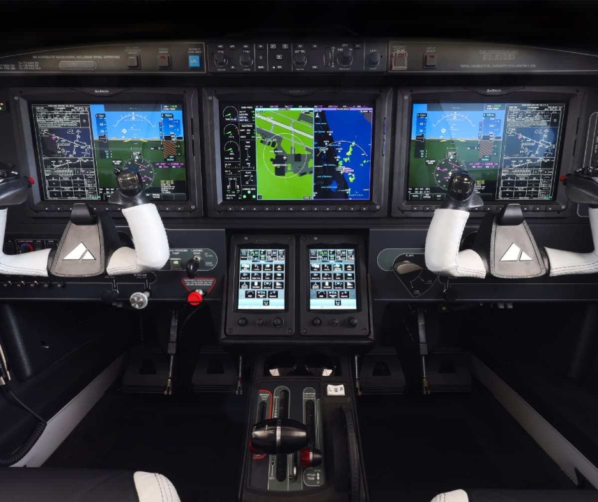
Piper Aircraft will offer a suite of connected aircraft management capabilities available on Garmin G3000-equipped M600/SLS later this spring.
Those capabilities are enabled by Garmin’s new PlaneSync technology, which includes a 4G LTE Cellular and Wi-Fi datalink that streamlines pre-flight and post-flight activities, according to Piper officials.
With PlaneSync, M600 owners can remotely check key aircraft and flight planning information, including fuel quantity, aircraft location, oil temperature, battery voltage, the current METAR at the aircraft’s location, and more via the Garmin Pilot application.
PlaneSync technology also automatically downloads databases wirelessly while the aircraft is powered down and the owner is away, eliminating the need to manually update databases, Piper officials added.
The latest M600/SLS will also include a host of additional updates, including enhancements to the synthetic vision system, onboard weather radar, navigation, flight planning, checklists, weight and balance calculation capabilities, and stabilized approach monitoring, company officials said.
“One of the most significant additions is the new 3D SafeTaxi, which expands situational awareness with an advanced 3D depiction of the ground environment, including airport markers, buildings, and other position markings,” Piper officials said in a prepared release. “Improved taxiway routing guidance provides both graphical and textual information, supporting the pilot at even the most complex airports. Additionally, M600/SLS customers will benefit from glide range ring functionality designed to improve situational awareness in the event of an engine power loss emergency.”