Garmin has introduced SmartCharts, an “aviation charting solution that will provide pilots with a simplified and intuitive experience by producing clear and relevant data to depict a chart tailored for their specific flight operation,” according to Garmin officials.
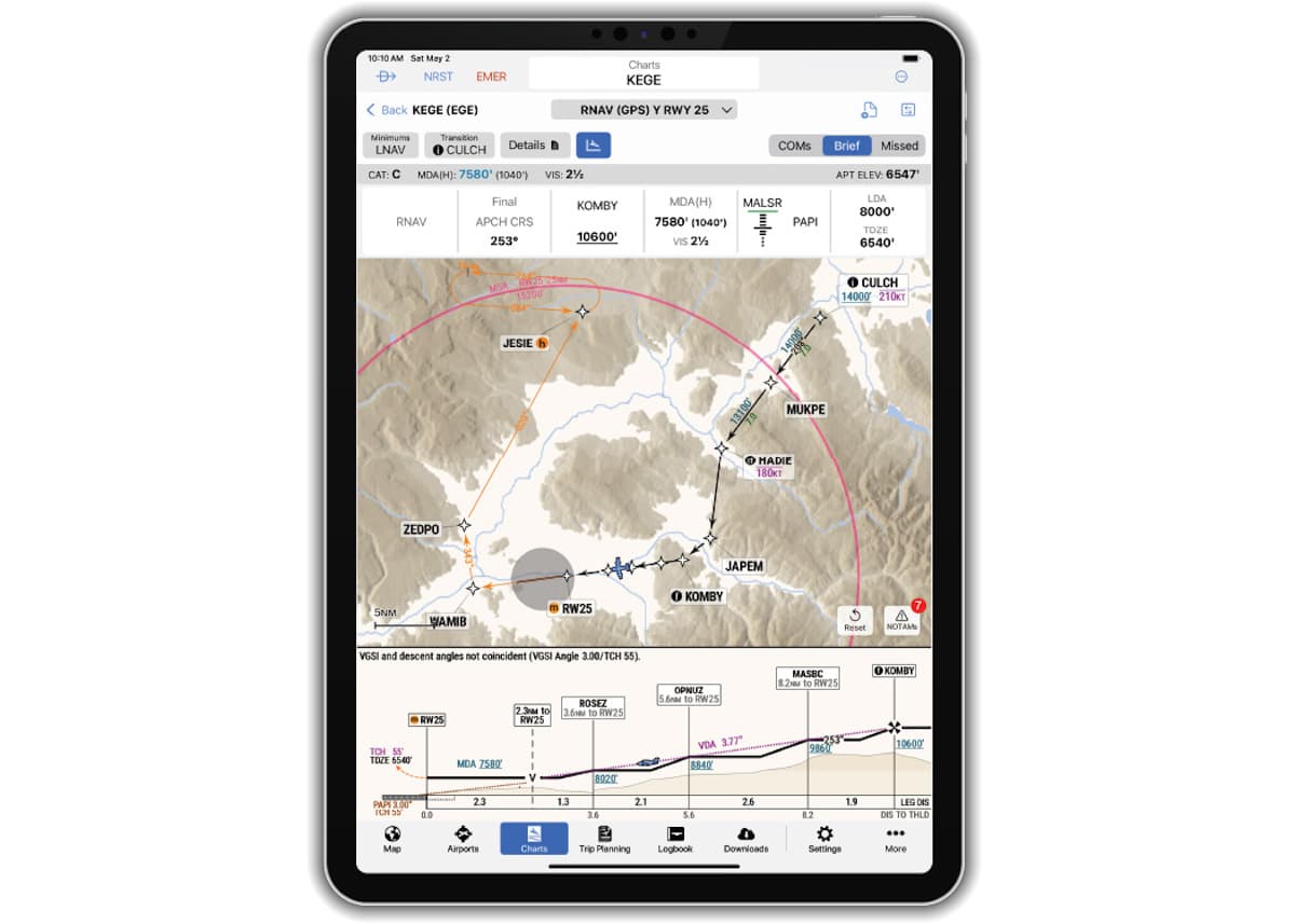
Initially available in the Garmin Pilot app, SmartCharts allows pilots to view simplified terminal procedures, including instrument approach procedures (IAP), departure procedure (DP), standard terminal arrival (STAR), airport diagrams, and more “so pilots can easily find and decipher needed information based on the phase of the procedure they are on,” company officials explained.
During an approach procedure, approach minima are updated and presented to the pilot via selection buttons for aircraft category, approach type (e.g. ILS, LOC, LPV, LNAV, etc.) and other adjustments like local or other altimeter settings, inoperative airport lighting, flight director or HUD use, and more.
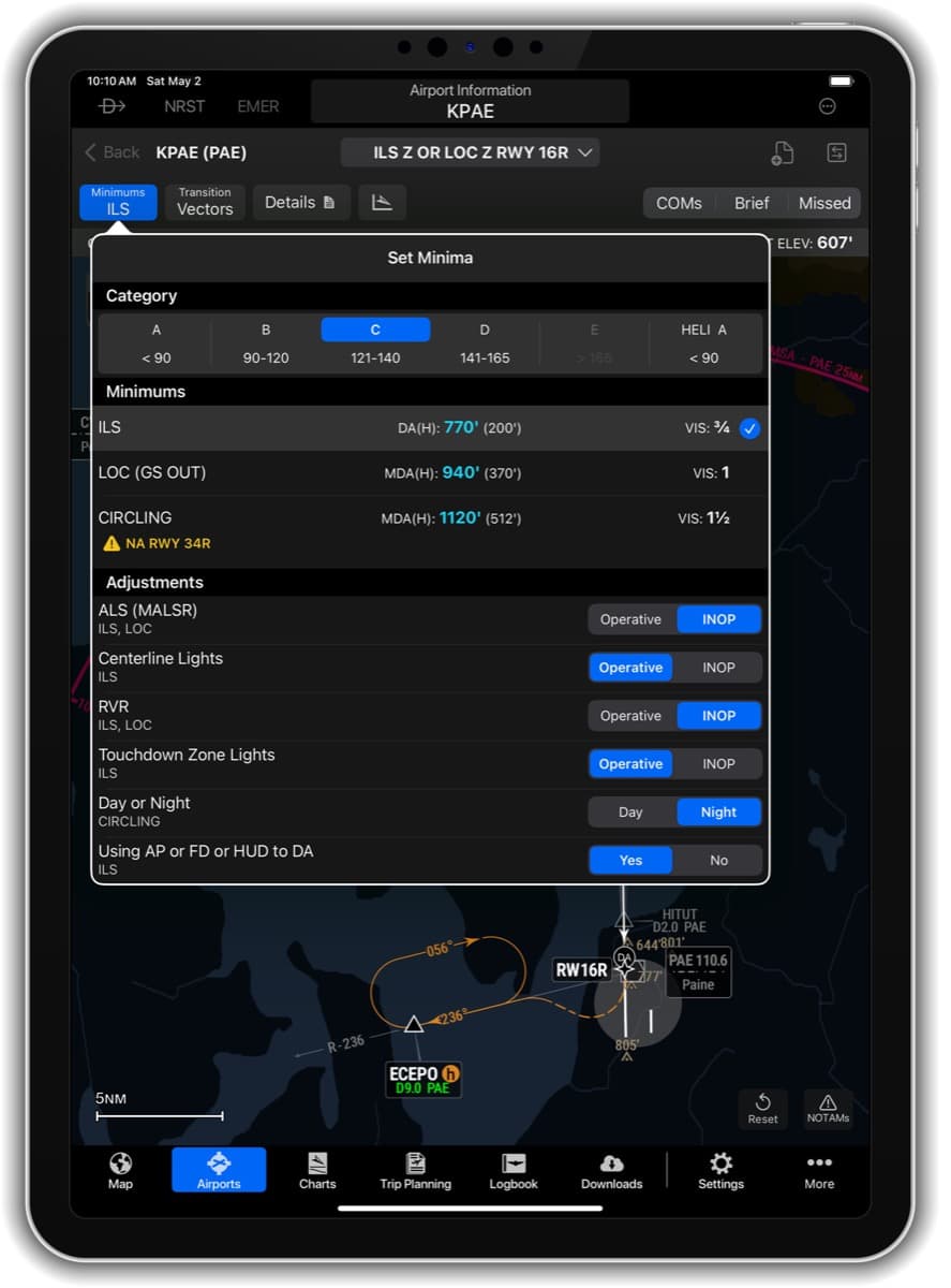
Those selections then present only one minima number to reference, eliminating the need for mental math with traditional charts, Garmin officials explained.
Waypoints, legs, crossing restrictions and other details are then clearly depicted on the chart as users make selections and adjustments. This ultimately removes unnecessary information from view, leaving the pilot with a single route in view to help reduce workload and the chance for errors, officials added.

After making selections on the chart, a simplified user-interface and layout allows for an intuitive briefing process, Garmin officials continued. Pressing the Brief, COMs, and Missed Approach buttons on each procedure will showcase necessary information during procedure setup and briefing, also meaning often-forgotten notes are now in the spotlight, they noted.
“In a first for the industry, the approach vertical profile view is geo-referenced with the aircraft appearing on the profile at its altitude,” company officials said. “This feature adds ultimate situational awareness of the aircraft position relative to the approach path, terrain and obstacles.”
SmartCharts is available via a Garmin Pilot Premium subscription for iOS devices in the United States and the Bahamas at launch. A free trial is available at Garmin.com/Aviation/GarminPilot/Downloads.
For more information: Garmin.com/SmartCharts