A new iOS app, Where2Fly2, helps pilots and aviation enthusiasts discover airports based on distance, runway length and surface type.
Built with official FAA National Airspace System Resource data, the app displays all airports within a selected range from an origin airport, making it useful for planning cross-country flights or quick getaways, according to the developers.
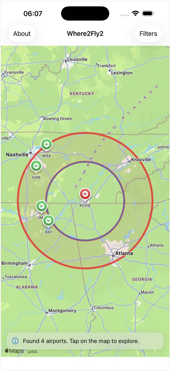
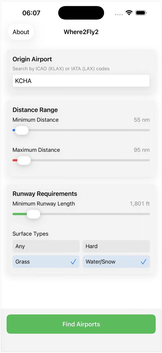
Pilots can set minimum and maximum distance ranges, filter by runway length from 1,000 to more than 8,000 feet, and select paved, grass, or water runways.
An interactive map shows distance rings and airport locations, while geodesic distance calculations provide precise planning. Only public use airports are shown.
The app works offline using cached data, and all processing is done locally — no data is collected or shared, according to company officials.
The app offers a 10-day free trial with full access to all features. After the trial, users can unlock lifetime access for a one-time purchase of $3.99.
For more information: Apple App Store
Leave a Reply