Garmin has introduced a new overlay option for SmartCharts, its aviation charting solution found in the Garmin Pilot app.
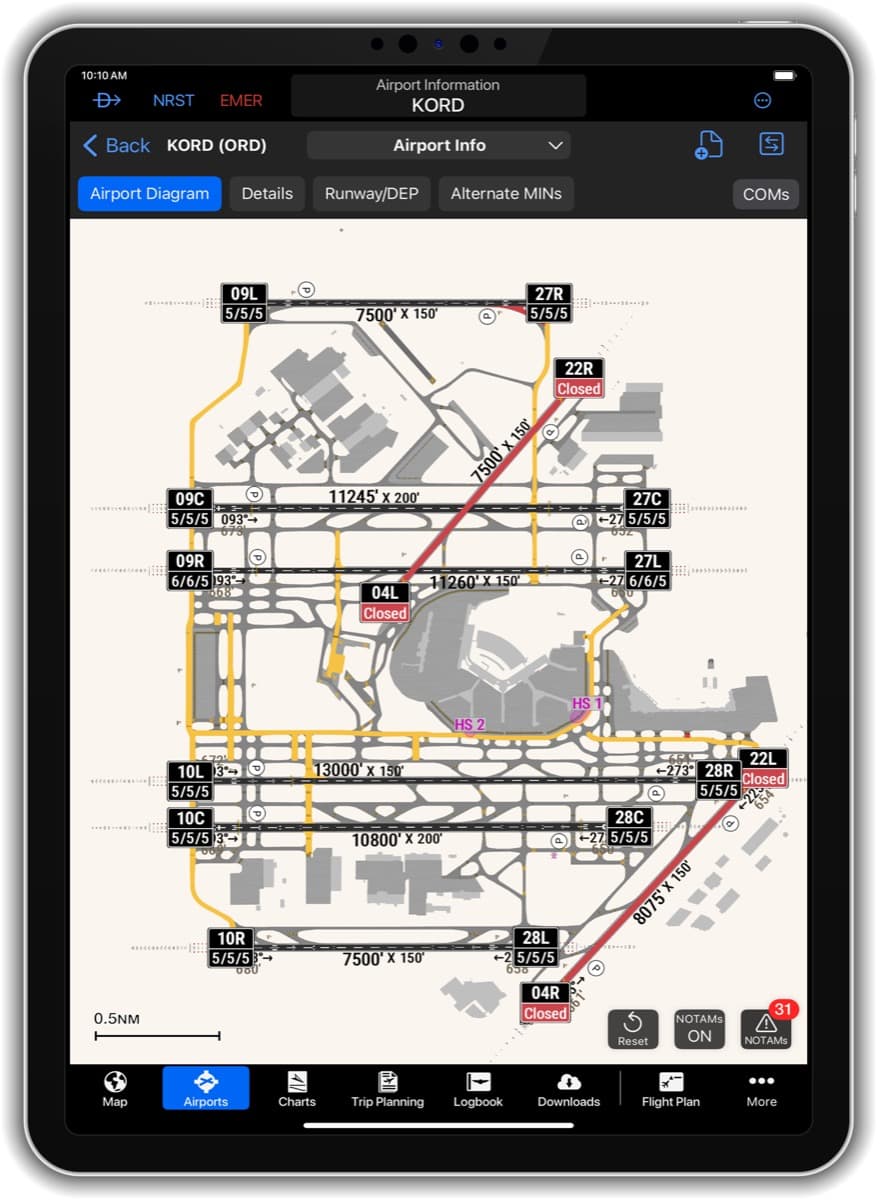
The new Graphical NOTAMs overlay, when selected “On,” will depict active runway, taxiway, and ramp closures, as well as conditional closures. Additionally, current field condition (FICON) codes will appear on the runway label, allowing pilots to see the runway conditions while viewing the airport diagram.
The Graphical NOTAMs overlay is color-coded for easy identification and interpretation of closures. When a runway, taxiway, or ramp is closed, they will be red. Closed runways will also have a yellow X at each end, Garmin officials explained.
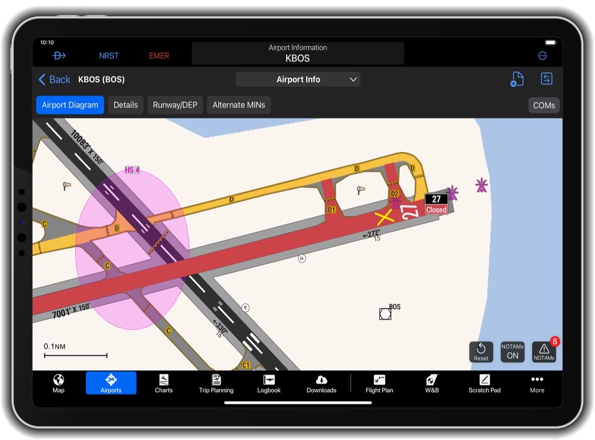
Conditionally closed runways and taxiways are depicted in yellow and require the pilot to review the NOTAM text to determine the closure details.
If a runway closure is time-based, a clock will be visible in the runway label.
FICON codes, shown in the runway label, are colorized based on the lowest number in the NOTAM. If there is a FICON NOTAM without a code, the word FICON is shown on the diagram instead.
In addition to Graphical NOTAMs, the Garmin Pilot mobile app has a new weather feature with the latest update. Storm Tops are now available, providing pilots with an additional tool to plan their flight around or through areas of weather.
Storm Tops depict the intensity of each storm, assisting pilots in deciding if they should go through, around, or over-top, company officials said. The new Storm Tops feature in the mobile app follows the recent addition of Storm Tops to Garmin Pilot Web.
SmartCharts is available via a Garmin Pilot Premium subscription for iOS devices.
For more information: Garmin.com/GarminPilot
Leave a Reply