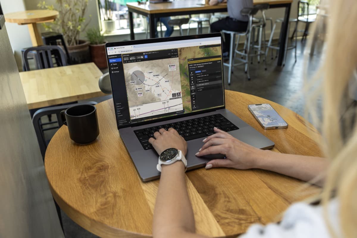
Garmin has integrated SmartCharts into Garmin Pilot Web, offering pilots information tailored to their flights.
Flight Planning
ForeFlight Training Course Takes Off
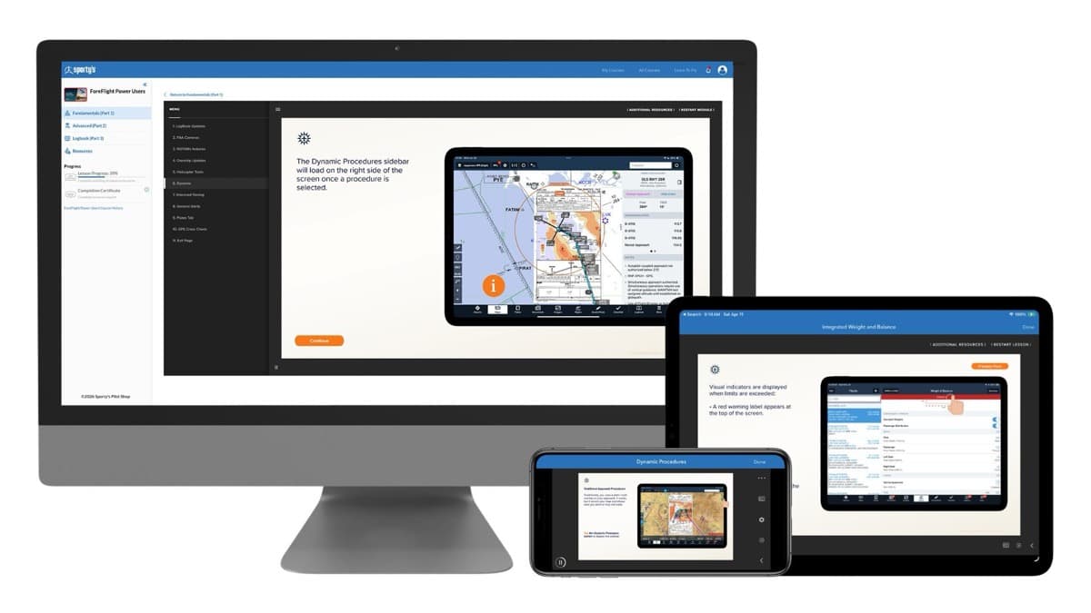
Designed for pilots of all experience levels, the course provides a real-world guide to using ForeFlight from initial setup and flight planning to advanced in-flight tools and digital logbook management.
Comments and Reviews Added to Garmin Pilot
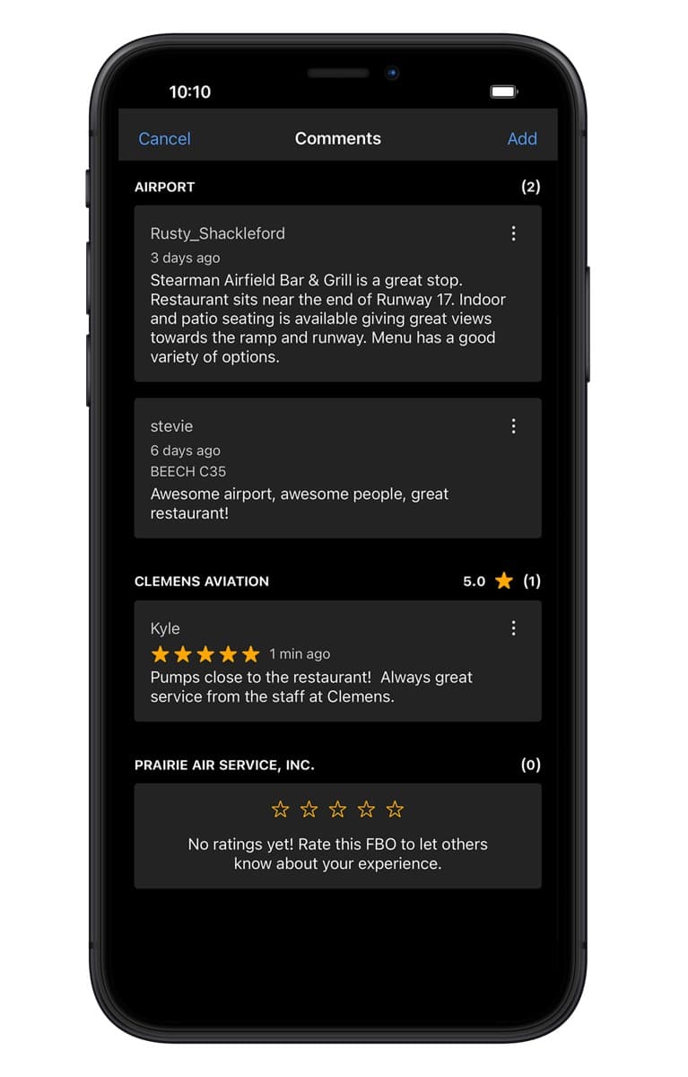
The new feature allows pilots to share local knowledge about an airport, from runway configurations to courtesy cars and restaurants.
Adventure Pilot Launches iFly EFB Version 14 with Satellite Imagery
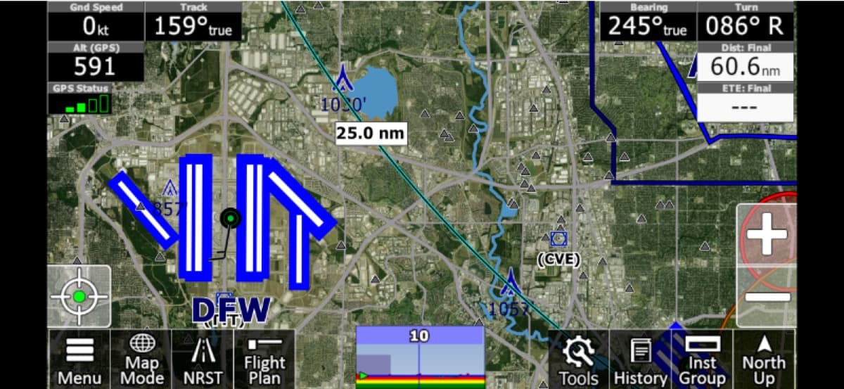
The most notable addition in the latest release is the new Satellite Imagery map layer, which offers pilots a real-world view of terrain and ground features. High-resolution imagery can be toggled as a map layer during planning or route reviews, providing a different perspective than traditional charts, company officials explain.
The Hybrid Cockpit
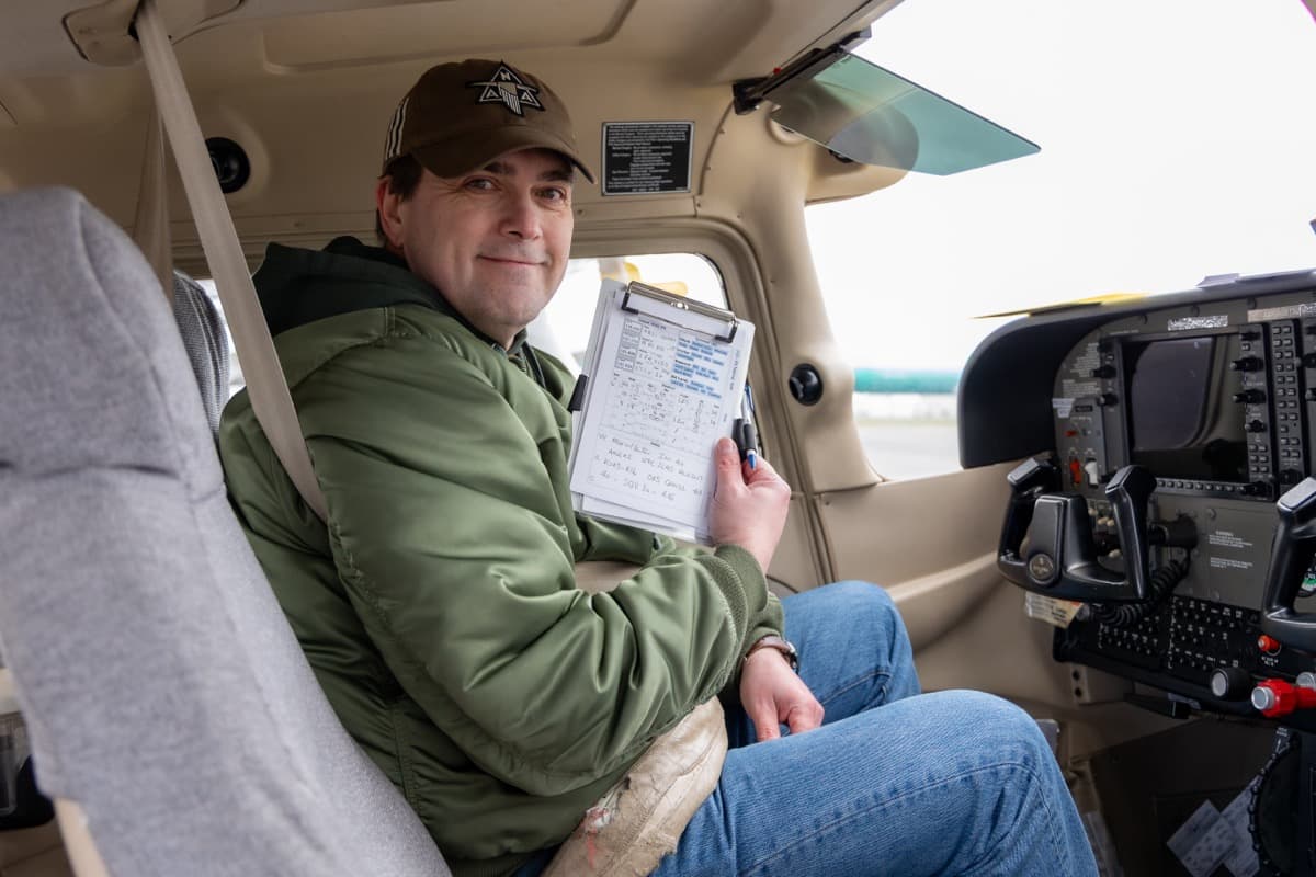
A Seattle pilot recently introduced GA Kneeboard, a platform that allows recreational pilots to bridge the gap between digital efficiency using the iPad and the analog reliability of paper on a kneeboard.
New Flight Planning Platform Seeks Beta Testers
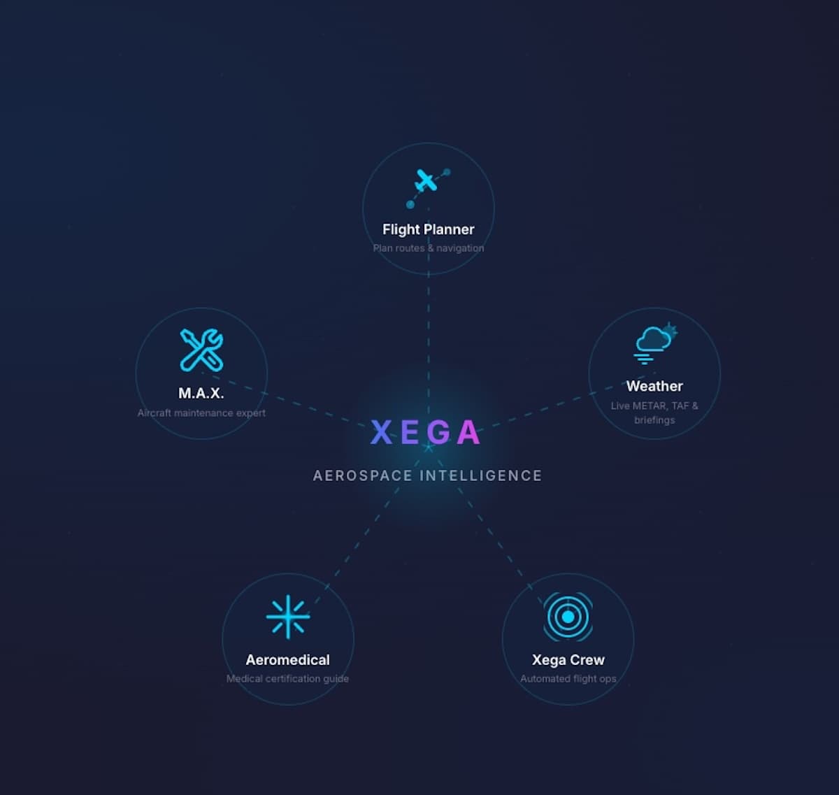
Xega, a new flight planning platform that includes a maintenance tracking and aeromedical component, has opened its Founders Beta testing, which it is limiting to 100 pilots. Active beta testers who use the platform and contribute feedback earn free lifetime access when Xega launches publicly.
New Tools Added to Garmin Pilot Web
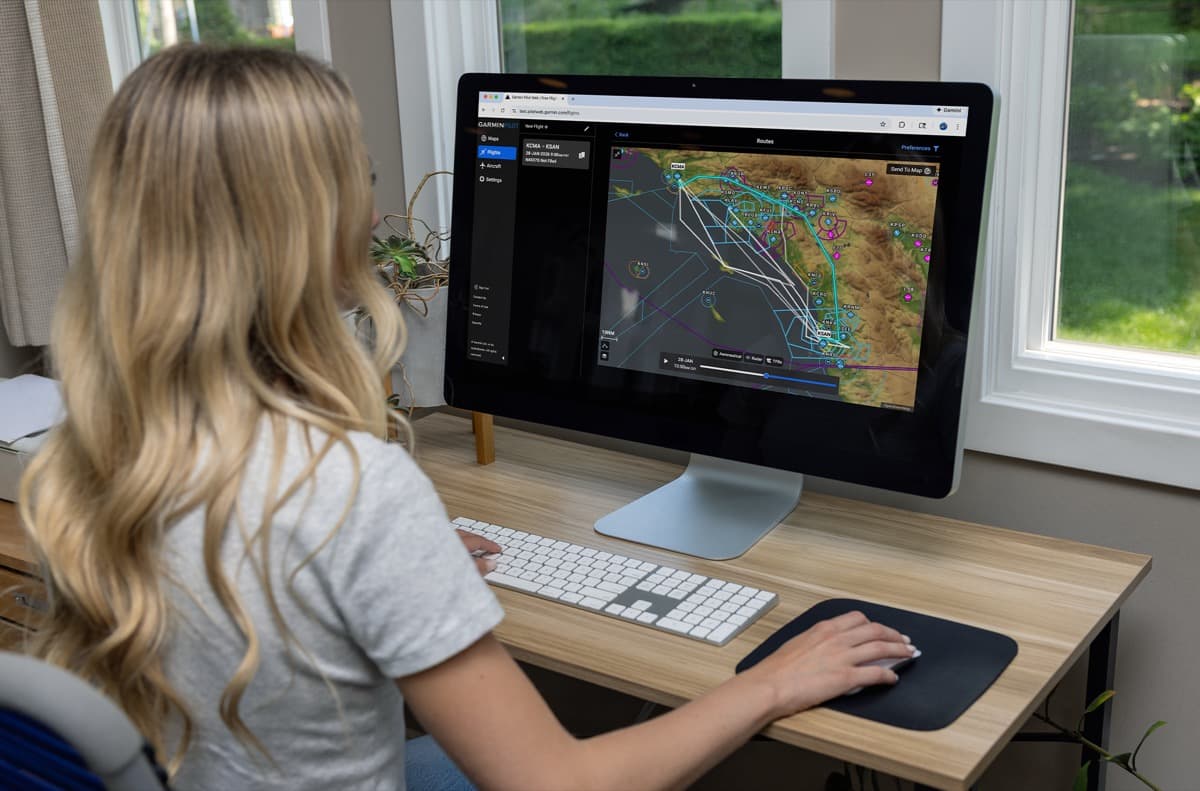
New routing tools join a new graphical editing feature to make flight planning easier for pilots.
iFlightPlanner Unveils Rebuilt Digital Logbook with Seamless ForeFlight Import
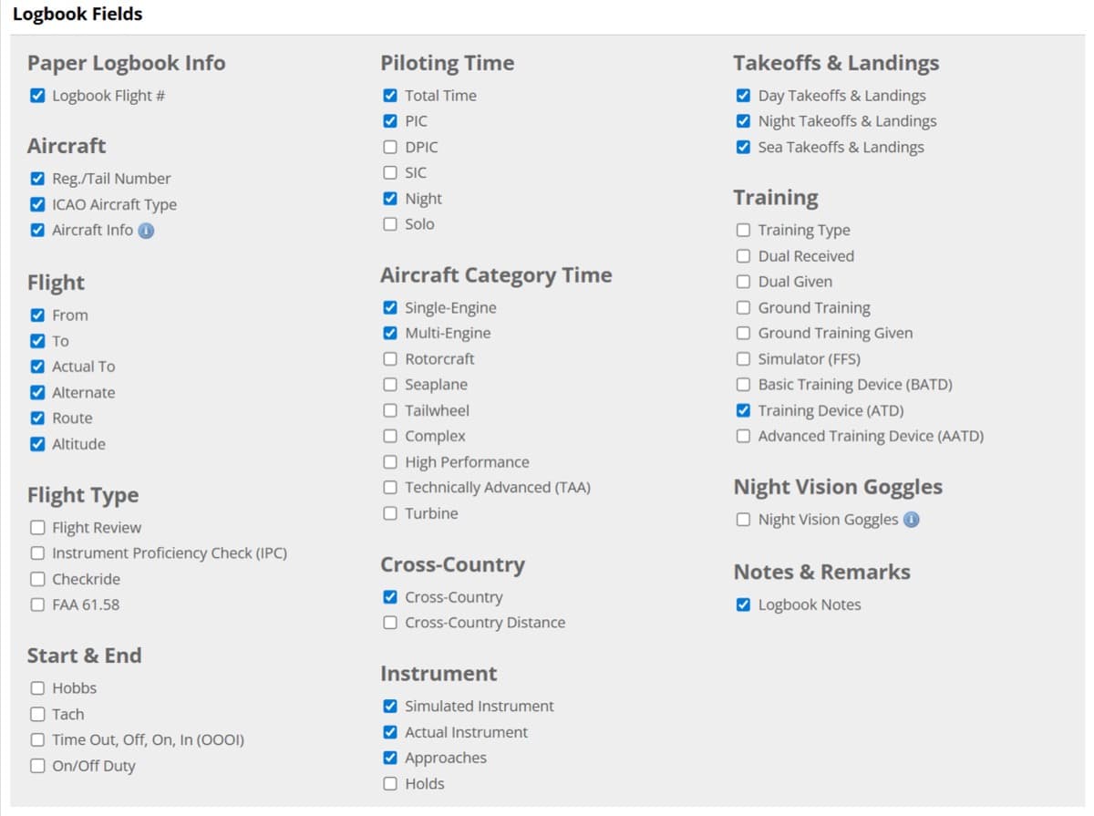
To make switching easier, iFlightPlanner Premium members can import their ForeFlight logbook using a direct, field-matched process.
A Flight Planning App Built For Today
Famous for his around-the-world flight and YouTube channel, Matt Guthmiller has launched 8Flight, a next-generation EFB. Designed to rival market leaders, the app offers real-time AI weather, offline planning, and streamlined flight intelligence for a modern cockpit experience.